|
Flytec is the name of a Swiss company whose digital flight instruments belong without a doubt among those at the absolute top of the world class.
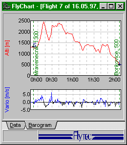
All instruments of the 40xx series have mostly the same features and characteristics. The higher end instruments of the series have special characteristics, like for example the ability to connect to GPS navigational systems, computation of polar profiles or barometric flight records.
Charging and Power Usage
Two AA-size batteries power the instruments. It is possible to use all types of batteries from alkaline to re-chargeable NiMH batteries. Power usage during operation fluctuates around 17mA, which means, with fully charged NiMH batteries with a capacity of 1,100mAh, approximately 65 hours of operating time. Using alkaline batteries makes this period 2 to 3 times longer. Beware however! Even after shutting off with the switch, instruments 4020 and 4030 absorb power at 0.5mA, for charging the memory circuits of the barometric recorder. Taking also into consideration the self de-charging effect of batteries, the capacity of 1,100mAh is used up after roughly two months, without ever turning the instrument on! It is therefore unanimously recommended to insert two new alkaline batteries at the start of every season, and to remove the batteries from the instruments for extended periods of inactivity. It is of course necessary, before so doing, to transfer data of interest from the instrument's memory to a computer, otherwise you will most certainly lose it within a few hours.
Temperature and Stability
From the more expensive models we expect, and rightfully so, a high degree of temperature stability of the altimeter data. The Flytec 4030, cooled by 30 degrees Celsius indicates a drop in altitude of a pithy 20m.
The following functions are constant throughout the entire series:
Altimeter
Is able to measure altitude up to 8,100m (24,000feet) to within 1m (3ft). The instrument always has two altimeters, one for measuring absolute (above sea level) altitudes and a second for measuring relative altitudes, relative for example to the altitude of the runway or landing strip.
Variometer
Determines amount of ascent or descent with sensitivity of 0.1m/s. These instruments show four different types of data, calculated using various methods and displayed in varied ways. The Analog variometer displays measured values with the help of a column indicator ranging from -8m/s to +8m/s with a differentiation of 0.2m and an adjustable sensitivity - speed of reaction. The Digital variometer shows the same quantity in a range of -20m/s to +20m/s with a precision of 0.1m/s. The Integrated variometer calculates the average variometer value of the digital for an elapsed interval of time, settable in a range from 1s to 35s. The Acoustic variometer indicates the amount of ascent or descent using special acoustic signals, of which it is possible to set the volume as well as their spread threshold.
Speedometer
Measures speed in relation to surrounding environment up to a velocity of 190km/h. It is necessary to hook up an external speed sensor, which is available in a wireless data transfer model, with a range of up to several meters. It is necessary, in addition to purchasing this external speed sensor, an instrument with the capability of receiving its signal. The normal instruments cannot do this! Placing it on the glider pole tested this wireless speed sensor, and the connection worked even through the canopy, clasps and various "scaffolding" materials. It was, unfortunately, shown that thanks to the thickening of streams above the carrying surface, the values measured by the speed sensor were pushed to higher readings and so the wireless speed sensor once again traveled down to the crossbar.
Thermometer
Measures temperature of the surroundings in degrees Fahrenheit or Celsius in a range of -30 to +70degrees C.
Time functions
Allows for exact measurement of three independent time elements. Real-Time which indicates the actual date and exact time. The Stopwatch measures elapsed time from its switch on. The Flight time clock determines the duration of the flight from the take-off.
Memory
Can hold information on the last 20 flights. The flight data is represented in memory by maximum values of altitudes reached ascent or descent, time duration of the flight and its date. The more advanced models have memory circuits for barographs of the flights, in lengths of up to 51 hours when measured in 15second intervals. The capacity is seemingly huge, but only until the connoisseur sets a very fine sampling interval, at a length of one second and also turns on the speed recorder. The stated 51 hours of memory immediately shrink to some two hours, which, let's admit it, isn't much!
|
Flytec 4005
is the basic model of the 40xx series. In contrast to the higher-end models, it's not filled with circuitry for communication with computers or printers nor does it have memory for flight barographs.
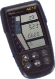
Flytec 4010
has concurrent characteristics with the 4005 model, but goes further in that it allows for data printout from its memory via a connected printer or transfer of data to a computer, where it can be manipulated with a database program, such as Flychart for Windows. It is not equipped with memory for flight barographs.
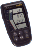
Flytec 4020
already comes equipped with special memory circuits for flight barographs and the related possibilities of calculating polar graphs of a give profile.


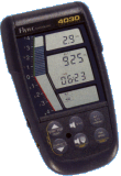
Flytec 4030
allows for connection of a GPS instrument with which it can communicate via the NMEA interface. Through uninterrupted uploading of information about current position in space from the GPS, automatic calculation of actual glide ratio, wind compensation, altitude setting for final approach and consequently optimization for gliding according to McCready's theory.

Instrument Acoustics
With increasing ascent not only does the tone interruption interval increase, (the instrument beeps faster), but also the pitch of the acoustic tone gets higher, multiplying the ability of the pilot to detect even very small changes. Unfortunately the acoustic differentiation of the instrument in the vicinity of zero is relatively small, in comparison for example, with the successful, today already somewhat forgotten, Alibi, which on the other hand very roughly determined ascents above 5m/s. It seems as if the Alibi was constructed more for pilots flying at Rané, while Flytec for competitiors in Owens Valley.
The Best for Last
If we enter the altitude of our desired goal for the glide into the Flytec 4030, and its coordinates into the connected GPS, Flytec wil inform us during ascent of two crucial moments. The first will arise during ascent when comes a time in which it is possible to attain your goal from your altitude, (the instrument knows the polar profile and wind carry ability). The second and by far the most important moment comes at the time when the sum of the time of ascent and flight time to the goal are the smallest, (time optimalization). If we leave off climbing, we will, during downgliding, reach the goal before pilots who left off ascending earlier, while pilots who left off ascent later will not catch up to us. While gliding to the goal, the instrument continuously shows whether we've deviated from the ideal connecting direction, up or down, and if it is necessary to speed up or slow down. A deviation to the side is shown by the GPS with the help of the "highway" function. Staying on the optimal pathway from the exit point to the goal is then really no problem. It's true that the pilot at this moment becomes a kind of puppet on digital LCD strings, but reaching the goal is worth it, is it not? And for the money ...
|


