|
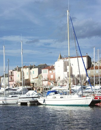
Ile Rousse
In the area between the towns of Calvi and Ile Rousse in the northwest section of the island there are several starting grounds that we intend to map out and of course try out as well. So we head off bright and early the next morning over the saddle by Serra du Pignu to the town of St. Florent. Directly above its port rises a 120m high hill with an unmistakeable northern slope, which, during a stronger northern streaming, be used for sloping. We are unable, however, to find a way up, as all around are private properties. Climbing the 120 elevation meters on foot surprisingly doesn't stir up any enthusiasm among us.
In the center of the town of St. Florent peace and calm dominate. The local inhabitants sit around on benches and watch the sweep of the balls in front of the church. Pentangle is maybe the most popular folk sport of the Corsicans. On every town square and in every public space one can find the specially prepared flat surfaces, covered with a thin layer of sand and surrounded by a low cement curb. This curb is to absorb the collisions of the balls, and is 'padded' on the inner side with wood and understandably surrounded by benches on all sides. The whisking of the metal balls is mastered by young and old alike with bravado. Our interest was held a long time by their truly masterful skill and enthusiasm for the game.
|
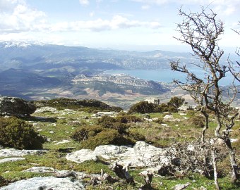
So we continue on the city of Ile Rousse and following the poor descriptions we'd had, we search for a starting ground in the mountains. At the westerly located starting ground of Bocca di Salvi, however , a strong southern wind blows, and the other starting ground we found in the right wind direction has, unfortunately, a problematic and unusable surface for take off. Furthermore, it's beginning to rain. At a parking lot in Ile Rousse we have a little snack and move across the central part of the island to the western shore, into the vicinity of the city of Ajaccio. The trip across the central part of the island is unbelievably long. A relatively very decent road twists up along the sides of the mountains and right back down again and the snow-covered peaks of the high mountains in the area of the town of Corte somewhat remind us of the High Tatra mountains. The crest past the town of Corte, in the direction towards Ajaccio rises to heights over 2500 meters and is surrounded by forested landscape literally shattered by narrow and unbelievably deep valleys with wild rivers and streams. This varied terrain makes this expansive island even more expansive. Even though in a straight line it is about 90km from the eastern to the western shore, it is about 150 by road, and that to be traversed at a low average speed.
It's already after dark that we finally find ourselves about 18km from the city of Ajaccio, in which in the year 1769 Napoleon was born, and we turn off through the village of Vero and up to the mountains. After about 12km along twisting serpentine roads through pine forests we are at the starting ground on a crest at an elevation of 890m above the sea and we build our camp. The sky is a shimmering black and the moon, in its last phase, with its cold light, makes the already low enough temperature seem colder. The lights of mountain villages flicker in the distance and the valley beneath the starting ground begins to fill with cooled air, in which a lake of fog rapidly forms. This is no time for heroics and I prepare two sleeping bags and a cap for the night.
|