Cross country flights and competitions (First part)
I believe that it is a normal evolution that a pilot, who has flown quite a lot of hours in the air, undertakes cross country flights. By cross country, I do not necessarily intend exceptional flights of hundreds kilometers, but simple kind of flights that give a pilot the possibility to cover a certain distance, during his flight's day. It doesn't matter if your flight starts at 10 o'clock in the morning or at 5 in the afternoon, the important thing is to use anything that is at your disposal.
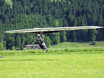
The wing is an amazing instrument, which allows you to learn about and admire the landscapes from the sky, sceneries that otherwise you never see. So why don't exploit this possibility? Every flight can be a small, spectacular trip.
First of all it is important to remind those, who wish to undertake these kind of flights, that the approach needs to be made step by step in order to avoid that after the first attempt, you decide to abandon the experience, because you feel too much unsafe. Keep the safety always on the first place!
The first time that you try to fly away from the usual local area, make sure that the weather conditions aren't too strong or that there isn't any fast climate change. If you have the possibility, fly with other pilots, perhaps in radio contact. It is even better if a more expert pilot can "accompany" you (in this case, you just need to be sure that this pilot doesn't leave you alone just when you need him the most).
At the beginning it will be very convenient (if not essential) to fly in well known places, if not know from "above" at least places you know from the "bottom". This way you don't need to lose your flight concentration by searching for landing places. It's important to carry out an overview (for example by car, map and pen in your hand) of the valley and the place that you intend to fly over, in order to assure yourself that in case of an emergency there is a landing possibility. While evaluating for a possible landing place you also need to consider the existence of power or phone lines, irrigation poles and barbed wires. These are obstacles that are particularly difficult to see when you're in the air. Of course you should also not underrate the fact that you never know in advance the wind conditions in the place you decide to land. Therefore try to consider only the biggest fields, those that are far away from eventual obstacles that prevent you to an easy approach or that can generate any rotors in the field that you chose to land on.
Another thing which is very useful, independently from the fact that you know or not know the area you want to fly through, is to make plan the route on a map before taking off. The planning of a route is used by any pilot flying whichever vehicle, so why shouldn't we use this same system in our free flight sport. You will see that this planning is very useful even if you use a GPS. In fact it allows you to memorize the morphology of the area you will be flying over and gives you an idea of the problems you may find during the flight. Once you memorized the coordinates of the different landing places on the GPS, you can move in the air keeping a constant eye on the safe places where you can land.
If you do not have a GPS you can trace the route and indicate the eventual landing places on the map. On the map you can also indicate the different flight altitudes you need in order to reach landable places, you can do this by indicating characteristic points which are easily recognizable in flight (e.g. a road, the top of a well known mountain, mountain refuge, river... etc). The flight altitudes that you will indicate on the map need to take into account the efficiency of your wing with, of course, a certain safety margin. For example, if your hang glider with top has 12 points of efficiency, just consider it has 10 or even 9 points and calculate your values with these figures.
|
I think that a normal touring map (for the Italians the "Touring Club Italia"), with a scale of 1:200000, will do fine for the planning of a flight. The details that these maps offer you are quite good, and do not take much space during the flight. If on the contrary you wish to deepen a bit more the morphology of the area, you can use a map with scale 1:100000. The satellite pictures offer an excellent aerial perspective of the area over which you fly, and on which you can almost see the landing areas (I say "almost" because you cannot see the eventual obstacle which might be on and around the landing fields).
Some pilots might not like to plan the flight on the map; it can seem that this way you restrict yourself the possibility to use your fantasy during the flights. As far as I'm concerned, in nasty winter days, I like to think that the map is a palette on which I can draw new routes (sorry for my poetic excess).
The study of the soil morphology on a map can appear to be a fundamental help in finding your way during the flight. You surely already had the occasion to realize that, an area which you know well by "feet" is quite different seen from the air. The map, which is nothing else but an "aerial picture" of the area, allows you to distinguish the different spots you are flying over.
In any case, if you like to use the map or not (luckily for us) no one forces us to stick to the "initial flight plan". We can change our plans as we like, at any time during the flight, according to our experiences and knowledge of the area were we are flying over. But we can of course plan a lot of different flight routes while we are comfortably sitting at home. This system is good especially for the beginner pilots so that they take off with only one or 2 possible routes in order to avoid wasting too much energy, concentration and time on deciding where to fly.
Reassuming
Chose an area, a route and weather conditions, which is suited to your skills. Plan your flight so that, once you are in the air, you understand where you are and where the landing areas are. Leave a large margin of safety for every decision you need to take while you are flying, meaning:
be always 200% sure that you can reach a landing area.
if you decide to fly with the wind to a ridge or an obstacle, do it only if you are sure that the wind is not too strong.
When you are at the take off, you can try to ask help to more expert pilots for the valuation of the capacity and conditions for the day, then you decide where to go and "explore".
|