|
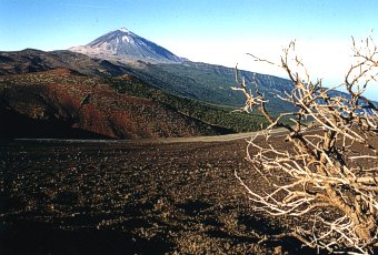
You would search in vain for the highest Spanish mountain on a map of Europe. Setting sight on the majestic Pico del Teide, whose sometimes snowy peak rises to a height of 3718 meters above the surface of the Atlantic Ocean, is possible only on the Canary Islands, and best of all directly on one of the biggest, the island of Tenerife.
The goal of our expedition to this most expansive of the Canary Islands was not, understandably to run up to the steep summit forcefully without using oxygen masks. The Czech aviationist sets out in winter for the Canary Islands above all for flying and we were very careful not to leave anything necessary for flying behind at home.
It was the 24 of December 1999, the last Christmas eve of the old millennium and on board the Boeing 737, flying at an altitude of 10,000 meters and a speed of 750km/h, a holiday atmosphere predominated. The plane was decorated for Christmas, the stewardesses gave out peanuts and snacks decorated with symbolic and very tasty marzipan Christmas trees with smiles, and outside the round windows of the plane was an impenetrable darkness and most of the passengers, if they didn't have those closest to them right there alongside, at least were with them in their thoughts, somewhere around a lighted Christmas tree ...
"When are they finally going to bring that carp and potato salad?!", the voice the always rationally thinking Milan pulled me out of my dreaming and before I was able to come back down into seat 13A out of my flying thoughts, he was pulling at the sleeve of a nearby flight attendant with a hungry look in his eyes. In the end there was no carp and potato salad, but Milan was able to fall asleep after finishing off an omelette just as well.
Following a five-hour flight, the airport Tenerife Sur on the sourthern side of the island greeted us with a clear sky, a pleasant northeast wind of 6km/s and a temperature of 24 degrees Celsius. Considering that we had left the Ostrava-Mošnov airport at a temperature of -12 degrees, it was a pleasant change.
Tenerife
With its area of 2057 square kilometers, Tenerife belongs among the largest of the Canary Islands and thanks to a 3718 meter high volcano, Pico del Teide, it is the highest island. The whole island was formed by the conglomoration of three smaller islands into one during a big volcano erruption and traces of volcanic activity, just like on Lanzarote, are everywhere. The last small volcanic erruption was in 1909, which however didn't come close to the intensity of the explosion in 1798 when the volcano Pico Viejo errupted for 3 months and 5 square kilometers of the island's surface were covered with lava.
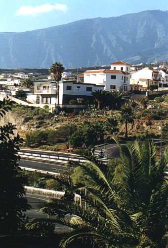
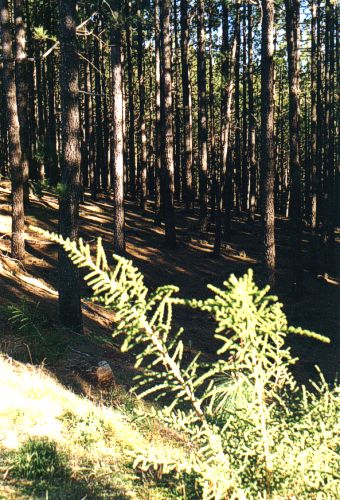
The majestic mountain crest Cumbre Dorsal divides the entire island lengthwise into the dry southern part and simultaneously the warmer part, on which can be found even the most well known beaches, as well as thermic terrains. The northern, cooler and more humid part is in a band of about 800 to 1600 meters above sea level, covered with very dense and deep forests, in which even grow a strange species of mushroom. Since, however, the dinner at the hotel was relatively satisfying, we didn't test their edibility. The band of forests on the southern side of the island is considerably thinner and drier and mushrooms do not fare well.
|
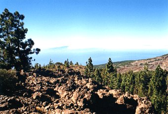
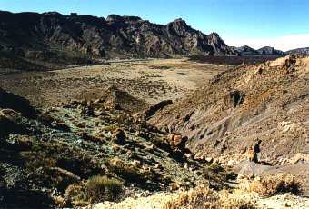
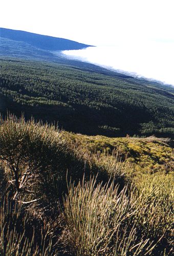
The appearance of abundant vegetation in this high range is of course not at all random. The Trade Winds create clouds on the windward slopes exactly at these altitudes and because it practically doesn't rain on the island, the moisture of the clouds is the only source of water for local plant life.
Following the morning warming of the slopes the rising humid ocean air begins to condense even on windless days in these altitudes, which means several unpleasant things for flying in these regions. The base cloud cover rarely gets above 1000m above sea level, which gives explicitly high ceilings. To turn ascent for example above the peak of Pico del Tiede is ruled out here. It is of course possible to fool local climactic conditions by taking off at 2,200 meters, but you immediately encounter the opposite problem. The cloud layer, often several hundred meters thick, lies far below the take off point and it is necessary to drop through it during your flight. Furthermore, the high wind speed at these altitudes often totally prevents any take off.
Prices on Tenerife
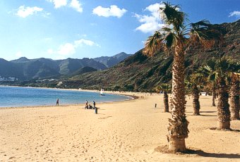
Prices are as mentione in the article about Lanzarote, only that rascal gasoline (Natural 95) has gotten more expensive during 1999 to 18 Czech Crowns per liter. For our fellow Czechs it is still a nice price, however. None of the highways on Tenerife require tolls and the speed limit is 120km/h. Beaches are also free of charge, but those who would expect white sand beaches on a volcanic island would be greatly dissappointed. Sand color on the beaches is dark grey to black, and the sand changes to rocks of the same color several meters from the water. The only exception is the artificially created beach of Las Teresitas on the eastern end of the island, onto which were shipped tons of golden sand from the Sahara, and even the regular spacing of the palm trees here the manmade origins are apparent.
|